🎟️ It's time to secure your spot! Our ticket shop is officially live and waiting for your bookings. 🌐 From September 24th to 26th, INTERGEO 2024, the international leading trade fair for Geodesy, Geoinformation, and Land Management, opens its doors. Innovators, speakers, and visitors from around the world get together to discover new trends, exchange ideas, and share their knowledge. ➡️ Prices and Information on the various ticket offers can be found here: https://lnkd.in/dkP6heC! We'll see you in Stuttgart! #INTERGEO2024 #Geospatial #Conference #InternationalGeocommunity #GeospatialEvent
INTERGEO Expo and Conference
Veranstaltungsdienste
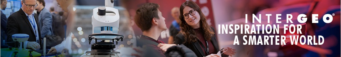
INSPIRATION FOR A SMARTER WORLD 24 - 26 September 2024, Stuttgart/Germany
Info
Die INTERGEO ist die weltweit führende Expo- und Conference-Plattform für Geoinformation, Geodaten und zentraler Innovation-Hub der Geobranche. Die INTERGEO 2024 findet statt vom 24. bis 26. September in der Messe Stuttgart , als hybrides Event mit EXPO, CONFERENCE und EXPO STAGE. Zugang nur mit gültigem Ticket- Vorab-Registrierung online notwendig.
- Website
-
https://www.intergeo.de/
Externer Link zu INTERGEO Expo and Conference
- Branche
- Veranstaltungsdienste
- Größe
- 11–50 Beschäftigte
- Hauptsitz
- Worldwide Community
- Gegründet
- 1995
- Spezialgebiete
- Geodäsie, Geodesy, Geoinformation, Land Management, UAV, GNSS, Geodata, Surveying, Vermessung, Geospatial, Big Data, Smart City, Drohnen, Digitalisierung, Geodatenmanagement, Virtual and Augmented Reality, BIM, UAS und Drones
Updates
-
The INTERGEO 2024, the world's leading event for geodesy, geoinformation, and land management, will transform the Stuttgart Trade Fair Center into a vibrant hub of innovation from September 24th to 26th! Immerse yourself in the fascinating world of the geospatial community, where experts and visionaries from around the globe come together to shape the future of our global landscape. 🛰️🌍 This international platform not only offers a glimpse beyond the horizon but also encourages creative collaboration across borders. Discover the limitless possibilities of geoinformation technologies and become part of a movement that collectively tackles global challenges. Join us and experience firsthand how innovation, research, and international cooperation are changing the world! 🚀🌐 Read more in the opening press release of INTERGEO 2024: https://lnkd.in/edybqBnG. 📰 Secure your Ticket for this year INTERGEO 2024 in Stuttgart: https://lnkd.in/dkP6heC. 🎫 Die INTERGEO 2024, das weltweit führende Event für Geodäsie, Geoinformation und Landmanagement, wird vom 24. bis 26. September die Messe Stuttgart in ein pulsierendes Zentrum der Innovation verwandeln! Tauchen Sie ein in die faszinierende Welt der Geospatial-Community, wo Experten und Visionäre aus aller Welt zusammenkommen, um die Zukunft unserer globalen Landschaft zu gestalten. 🛰️🌍 Diese internationale Plattform bietet nicht nur einen Blick über den Tellerrand, sondern ermutigt auch zur kreativen Zusammenarbeit über Grenzen hinweg. Entdecken Sie die unbegrenzten Möglichkeiten der Geoinformationstechnologien und werden Sie Teil einer Bewegung, die gemeinsam globale Herausforderungen meistert. Seien Sie dabei und erleben Sie hautnah, wie Innovation, Forschung und internationale Kooperationen die Welt verändern! 🚀🌐 Lesen Sie mehr dazu in unserer Auftakt-Pressemitteilung für die INTERGEO 2024: https://lnkd.in/eBFBSf7a. 📰 Sichern Sie sich jetzt Ihr Ticket für die diesjährige INTERGEO 2024 in Stuttgart: https://lnkd.in/dXtx2_Y. 🎫
-
-
Data from Earth observation is indispensable for climate-resilient urban planning! 🌍 Dr. Annett Frick, Head of Remote Sensing Department at LUP - Luftbild Umwelt Planung GmbH, captivated the audience at the INTERGEO 2023 EXPO STAGE with this topic! 🚀 In a world confronted with escalating climate risks and urbanization, geospatial data, remote sensing, and advanced analytics are crucial. Dr. Frick's presentation emphasizes the importance of satellite imagery, LiDAR scans, and real-time monitoring for identifying vulnerabilities and risk assessment. 🛰️ Discover how cities can utilize this data to transition to proactive and sustainable urban resilience. 🏙️ Listen to the entire presentation in our EXPO STAGE media library on our YouTube channel – find the link here https://lnkd.in/eDarBCvd! Daten aus der Erdbeobachtung sind unverzichtbar für eine klimaresiliente Stadtplanung! Dr. Annett Frick, Head of Remote Sensing Department bei Luftbild Umwelt Planung GmbH, begeisterte das Publikum auf der EXPO STAGE der INTERGEO 2023 mit diesem Thema! 🚀 In einer Welt, die mit zunehmenden Klimarisiken und Urbanisierung konfrontiert ist, sind geografische Daten, Fernerkundung und fortschrittliche Analysen entscheidend. Dr. Fricks Vortrag hebt die Bedeutung von Satellitenbildern, LiDAR-Scans und Echtzeitüberwachung für die Identifizierung von Schwachstellen und Risikobewertung hervor. 🛰️ Erfahren Sie, wie Städte diese Daten nutzen können, um den Übergang zu einer proaktiven und nachhaltigen städtischen Resilienz zu vollziehen. 🏙️ Hören Sie sich den gesamten Vortrag in unserer EXPO STAGE Mediathek auf unserem YouTube-Kanal an – den Link finden Sie hier: https://lnkd.in/eDarBCvd! #INTERGEO2023 #LUP #Satellite #EarthObservation
-
🍽️ Do you want to take advantage of the fact that INTERGEO 2024 is in Stuttgart? Then you should consider visiting two shopping destinations: "Stuttgarter Markthalle" to try fresh and regional delicacies and “Milaneo Stuttgart” with a huge variety of shopping opportunities. 🏛️ You can, for example, buy different kinds of fish, meat, cheese, bread, and herbs, among other things at Stuttgarter Markthalle. If you want to try something different, there are also a lot of shops selling Asian, Italian, Hungarian, Swiss, and Spanish specialties. 🍴🥗 Almost 110 years old, the "Stuttgarter Markthalle" has been a hub of trade and culture. Despite modernization, it offers a unique shopping experience with a blend of fresh produce, diverse goods, and historical architecture. 🛍️ On the other side the Milaneo Stuttgart is a three-part complex in Stuttgart, featuring a shopping center spanning approximately 43,000 square meters of retail space. Aside from offering plenty of shopping opportunities, the main/first floor boasts a wide range of dining options. 🍴🍔 From burgers, pizza, and Turkish and Asian cuisine to delectable desserts like donuts, there's something for every palate.Aside from offering a plethora of shopping opportunities, the Milaneo Stuttgart main/first floor boasts a wide array of dining options. From burgers, pizza, and Turkish and Asian cuisine to delectable desserts like donuts, there's something for every palate. 🛒 Enjoy the vibrant atmosphere and discover the flavors of Stuttgart at the Markthalle or get yourself indulging in a shopping spree at Milaneo! Opening hours: Mon-Fri 07:30AM-06:30PM, Sat 7AM-5PM Adress: Dorotheenstraße 4, 70173 Stuttgart #INTERGEO2024 #Geospatial #Stuttgart #Geoinformation #Geoinformatic
-
Discover heat hotspots and cooling patterns! 🌟 At the EXPO STAGE of INTERGEO 2023, Tobias Leismann, Innovative Lead at constellr GmbH, presented the company's innovative satellite technology. Overnight, cooling patterns are measured, green areas with cooling effects are identified, and heat hotspots that require urgent action are pinpointed. 🌳♨️ The importance of climate resilience in urban areas is increasing, especially as over 50% of the world's population live in cities. 🏙️ Join Mr. Leismann as he provides deeper insights into precise temperature data collection and discusses approaches supporting digital urban planning. You can watch the entire presentation here: https://lnkd.in/eGEcWSFN. 🎥🔗 Entdecken Sie Wärmehotspots und Kühlungsmuster! 🌟 Auf der EXPO STAGE der INTERGEO 2023 präsentierte Tobias Leismann, Innovative Lead bei constellr GmbH, die innovative Satellitentechnologie des Unternehmens. Über Nacht werden Kühlungsmuster gemessen und grüne Flächen mit Kühlwirkung identifiziert, sowie Wärmehotspots die dringendes Handeln erfordern. 🌳♨️ Die Klimaresilienz in städtischen Gebieten nimmt an Bedeutung zu, insbesondere da über 50% der Weltbevölkerung in Städten leben. 🏙️ Begleiten Sie Herrn Leismann, während er tiefere Einblicke in die präzise Erfassung von Temperaturdaten liefert sowie Ansätze erläutert, die die digitale städtische Planung unterstützen. Den gesamten Vortrag können Sie sich hier ansehen: https://lnkd.in/eGEcWSFN. 🎥🔗 #INTERGEO2023 #Geospatial #SatelliteTechnology #Constellr
-
🌟 Let's take a look back at the highlights of INTERGEO 2023 and gather inspiration for the upcoming INTERGEO 2024 in Stuttgart from September 24th to 26th! 🔍📊 The Post-Show Report offers a fascinating retrospective with important figures, data, and facts about INTERGEO 2023. Gain deeper insights into trend topics ranging from artificial intelligence to earth observation and Smart Cities. 🔗 Read more about it here: https://lnkd.in/ecFVib6q!. 🔗 Get your EXPO-Ticket now: https://lnkd.in/e2Y47RQg!. 🌟 Werfen wir einen Blick zurück auf die Highlights der INTERGEO 2023 und holen uns Inspirationen für die bevorstehende INTERGEO 2024 in Stuttgart vom 24. bis 26. September ein! 🔍📊 Der Post-Show-Report bietet einen faszinierenden Rückblick mit wichtigen Zahlen, daten und Fakten rund um die INTERGEO 2023. Erhalten Sie tiefergehende Einblicke in die Trendthemen von künstlicher Intelligenz über Erdbeobachtung bis hin zu Smart Cities. 🔗 Lesen Sie jetzt mehr dazu hier: https://lnkd.in/evBr6jJz!. 🔗 Erhalten Sie ihr EXPO-Ticket jetzt: https://lnkd.in/eqKYuQ8S!. #INTERGEO2023 #Geodäsie #Geospatial #SmartCities #EarthObservation #ArtificialIntelligence
-
-
Deepen your knowledge about the world of water engineering monitoring! 🌊 Charly Kühne from the Federal Waterways Engineering and Research Institut presented an exciting lecture on this topic at the EXPO STAGE of INTERGEO 2023 in Berlin. 🎤 In Germany, monitoring of massive water engineering structures is increasingly important as infrastructure ages and the safety of shipping traffic must be ensured. Automatic monitoring systems are essential for detecting potential damages early and ensuring structural stability. The presentation offers fascinating insights into the development of monitoring systems and addresses the challenges that users, such as the Federal Waterways Engineering and Research Institute, are dealing with. Learn more about innovative inclinometers and their long-term stability! You can watch the entire presentation here: https://lnkd.in/edXxG2m8. 🎥💡 Vertiefe dein Wissen über die Welt des Wasserbau-Monitorings! 🌊 Charly Kühne von der BAW • Bundesanstalt für Wasserbau präsentierte in diesem Zusammenhang einen spannenden Vortrag auf der EXPO STAGE der INTERGEO 2023 in Berlin. 🎤 In Deutschland gewinnt das Monitoring massiver Wasserbauwerke zunehmend an Bedeutung, da die Infrastruktur altert und die Sicherheit des Schiffsverkehrs gewährleistet werden muss. Automatische Überwachungssysteme sind unerlässlich, um potenzielle Schäden frühzeitig zu erkennen und strukturelle Stabilität zu gewährleisten. Der Vortrag bietet faszinierende Einblicke in die Entwicklung von Überwachungssystemen und behandelt die Problemstellungen mit denen sich Anwender, wie die Bundesanstalt für Wasserbau auseinandersetzt. Erfahren Sie mehr über innovative Neigungssensoren und ihre Langzeitstabilität! Den gesamten Vortrag finden Sie hier: https://lnkd.in/edXxG2m8. 🎥💡 #INTERGEO2023 #BundesanstaltfürWasserbau #Monitoring #Infrastructure #Geospatialcommunity
-
🌸 With the arrival of spring, the flowers begin to bloom, the birds are chirping away and the INTERGEO team is bustling with excitement as we prepare for INTERGEO 2024 in Stuttgart. 🐰 Until then, take the chance and let your ideas blossom at the CALL FOR IDEAS! Follow this link: https://lnkd.in/e7XNJBiE to become a speaker for INTERGEO 2024!
-
-
🛏 Finding the perfect accommodation can be a challenge! 📋 To assist you in your planning and looking forward to INTERGEO 2024, our partner https://lnkd.in/dTWr7wr is here to help! 🎫 With attractive offers and easy booking, you can find the suitable accommodation in Stuttgart as soon as possible. For more information ➡️ https://lnkd.in/eqjdt9T7 🛏 Die perfekte Unterkunft zu finden kann eine Herausforderung sein! 📋 Um Ihnen dabei zu helfen, diesen Punkt in Ihrer Planung schnell abzuhaken und sich auf die INTERGEO 2024 zu freuen, steht Ihnen unser Partner https://lnkd.in/dTWr7wr zur Seite! 🎫 Mit attraktiven Angeboten und einer einfachen Buchung finden Sie so schnell wie möglich die passende Unterkunft in Stuttgart. Erfahren Sie mehr ➡️ https://lnkd.in/eyz635dq
-
-
Dive into the fascinating world of 3D reconstruction! 🚀 At the EXPO STAGE of INTERGEO 2023, Federica Pederzani, Product Manager at Stonex, captivated the audience with a presentation, sharing intriguing insights and detailed information about a new and unique technology from Stonex. Discover the innovative Stonex XVS System, based on vSLAM algorithms (Visual Simultaneous Localization and Mapping) – for simple and fast 3D capture with impressive precision and resolution. A careful selection process further refines the frames to optimize the quality of the 3D data. 🌐✨ Watch the complete presentation for free here https://lnkd.in/eSm7avWJ. 📽️🔗 Tauche ein in die faszinierende Welt der 3D-Rekonstruktion! 🚀 Auf der EXPO STAGE der INTERGEO 2023 begeisterte Federica Pederzani, Produktmanagerin bei Stonex, mit einem spannenden Vortrag und teilte interessante Einblicke sowie detaillierte Informationen über eine neue und einzigartige Technologie von Stonex. Entdecke das innovative Stonex XVS System, das auf vSLAM-Algorithmen (Visual Simultaneous Localization and Mapping) basiert – für eine einfache und schnelle 3D-Erfassung sowie beeindruckende Präzision und Auflösung. Ein sorgfältiger Auswahlprozess verfeinert zudem die Frames, um die Qualität der 3D-Daten zu optimieren. 🌐✨ Schauen Sie sich den kompletten Vortrag kostenfrei hier an https://lnkd.in/eSm7avWJ. 📽️🔗 #Intergeo2023 #Stonex #3Dmapping #Geospatial #3Dmodeling